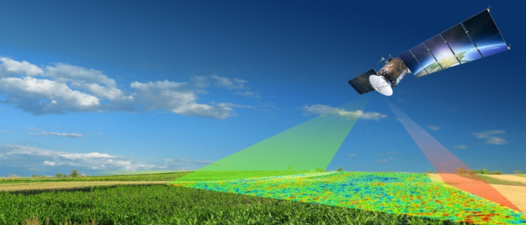
🛰️ Satellite Monitoring for Crop Health
Introduction
Modern farming is no longer limited to what farmers can see with their eyes. With satellite technology, it’s now possible to monitor crop health from space. This innovation provides farmers with real-time insights into soil conditions, plant growth, and potential threats—helping them make smarter decisions, reduce losses, and increase yields.
🌍 Why Satellite Monitoring Matters
- Early Detection: Identifies crop stress before it becomes visible to the naked eye.
- Precision Agriculture: Helps farmers apply water, fertilizer, and pesticides only where needed.
- Cost Efficiency: Reduces waste and maximizes resource use.
- Climate Resilience: Tracks drought, floods, and temperature changes to support adaptation.
- Market Advantage: Ensures consistent quality and better planning for harvests.
🛠️ How Satellite Monitoring Works
- Remote Sensing: Satellites capture images using different wavelengths (visible, infrared, thermal).
- Vegetation Indices (e.g., NDVI): Measures plant “greenness” to assess photosynthesis and growth.
- Soil Moisture Mapping: Detects water levels in soil to guide irrigation.
- Pest & Disease Alerts: Identifies unusual patterns that may signal infestations.
- Yield Forecasting: Predicts harvest volumes based on crop health data.
🌿 Practical Applications for Farmers
- Irrigation Management: Pinpoint areas that need more or less water.
- Fertilizer Optimization: Apply nutrients only where deficiencies are detected.
- Pest Control: Target affected zones instead of spraying entire fields.
- Crop Rotation Planning: Use long-term satellite data to improve soil fertility.
- Insurance & Finance: Provide evidence of crop conditions for claims or loans.
⚠️ Challenges & Solutions
- Access to Technology: Many smallholder farmers lack direct access—solutions include mobile apps and cooperatives.
- Data Interpretation: Raw satellite data can be complex—training and extension services help bridge the gap.
- Connectivity Issues: Rural areas may struggle with internet access—offline tools and SMS-based alerts can help.
- Cost Barriers: Partnerships with NGOs, governments, and agritech startups can make services affordable.
Conclusion
Satellite monitoring is transforming agriculture into a data-driven, climate-smart industry. By harnessing space technology, farmers can detect problems early, optimize resources, and secure better harvests. For Africa and beyond, this innovation represents a powerful step toward sustainable food security and resilient farming systems.

DONATE & HELP FEED THE WORLD- PRESS THE LINK BELOW AND DONATE- https://www.paypal.com/donate/?hosted_button_id=XBTLE4H5G322N
Your support helps AgriHelpAfrica share sustainable farming practices with the world, one post at a time. Together, we can cultivate resilience, empower farmers, and grow a future where agriculture thrives and feed’s the world .


Leave a Reply